| |
Saturday, 6th September
Flight Düsseldorf - Detroit - Denver
Once again
we got drawn to the American Southwest, this time to explore less
trodden paths that can mostly be reached via dirt roads only, or on foot.
Our flight from Düsseldorf was supposed to leave at
1:15 p.m., however, when we arrived we realized that it had been
rescheduled to 4 p.m. which meant that we would most likely miss our
connection in Detroit. We finally took off at 4:30 p.m. and after 9 hours flight
time we arrived in Detroit. It was 7:45 p.m. local time. Our connecting
flight was probably taking off right now. Airline staff
was already waiting with hotel and food vouchers. A shuttle bus took us
to the Clarion Hotel Detroit Metro Airport. At 5 a.m. German time we
finally fell into bed... At least we were able to cancel the Drury Inn Denver East
($76 plus tax) that we had booked for the night of our arrival in
Colorado.
|
|
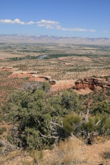
Sunday, 7th September, approx. 30 °C, sunny
Denver - Georgetown - Rifle Falls State Park -
Grand Junction
Total miles: 303
Accommodation: Super 8, Grand Junction
Our flight to Denver the next morning took off at 9
a.m. We had a view of Chicago from above and just before
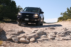
landing in Denver at 10:15 a.m. local time we could see the Rockies in the distance. We had booked a Midsize SUV
with Alamo but when we arrived at the choice line we were allowed to take any car we
chose and there were the larger standard SUVs only, so we picked a Chevrolet Trailblazer,
brandnew with just 180 miles on the speedometer.
 It was 12 p.m. when we
left the airport area. We drove west on the
I-70,
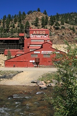
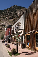
stopped in Idaho Springs and in historic Georgetown. After crossing the
mountains we reached Glenwood Springs (due to our late arrival in Denver
we didn't get to hike the
Hanging Lake Trail).
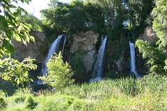
It was 4 p.m. already, nevertheless we took the short detour to the
Rifle Falls
State Park ($6 per
car). It was 12 p.m. when we
left the airport area. We drove west on the
I-70,
stopped in Idaho Springs and in historic Georgetown. After crossing the
mountains we reached Glenwood Springs (due to our late arrival in Denver
we didn't get to hike the
Hanging Lake Trail).
It was 4 p.m. already, nevertheless we took the short detour to the
Rifle Falls
State Park ($6 per
car).
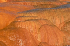
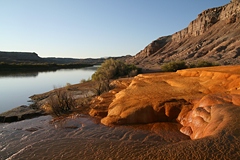
At 7 p.m. we reached Grand Junction where we had booked the Super 8 motel ($65 plus
tax AAA rate) for two nights. We didn't feel hungry, so we simply had a
salad from Safeway for dinner.
|
 |
 |
 |
 |
 |
 |
 |
 |
 |
Thursday,
11th September,
28 °C, mostly sunny, a short rain shower
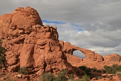
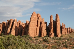
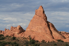
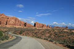
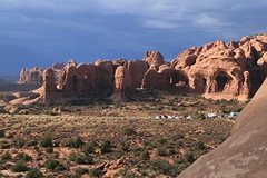
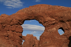
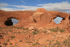
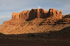
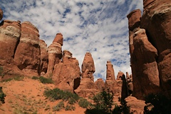
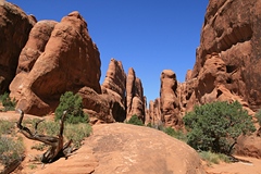
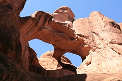
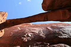
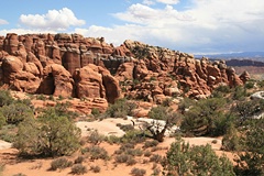
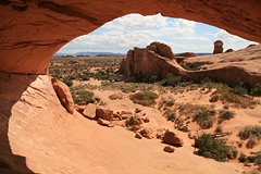
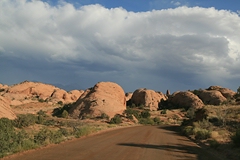
Arches NP (Fiery Furnace, Eye of the Whale Arch), Sand Flats Road, La Sal Mountains
Total Miles: 136
Accommodation: Inca Inn, Moab
At 10 a.m. we started on the ranger-guided tour of the Fiery
Furnace in Arches National Park ($10 per person). The hike was a total
of 2.2
miles, at a slow pace, but some climbing was involved. It took 3.5 hours
with the group
of 34. The guide also pointed out why it is so important to avoid stepping on the
fragile biological soil crust.
After this we drove to Delicate Arch Viewpoint. We did the short
hike to the upper viewpoint but quickly ran down again when thunder and
lightning came up! We fled the rain shower and drove to Balanced Rock.
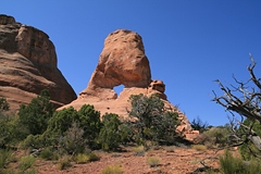
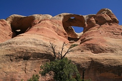
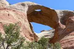
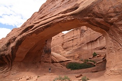
Here we turned onto the sandy 4WD road to the Klondike Bluffs. It was
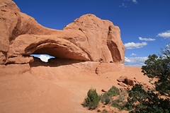
2:30 p.m. We drove the 1.9 miles to Eye of the Whale Arch
and explored the area on foot. Afterwards we drove back to Moab and onto
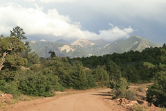
Sand Flats Road up to the La Sal Mountains
and towards Castle Valley. We were back in Moab at 7 p.m. Here we met
with Mike who was staying at the same motel and we went for dinner at
the Moab Brewery together.
|
 |
 |
 |
 |
 |
 |
 |
 |
 |
 |
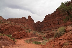
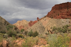
Friday,
12th September,
22 °C, sunny
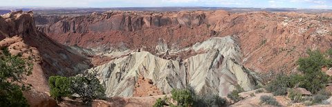
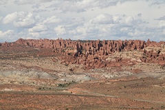
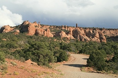
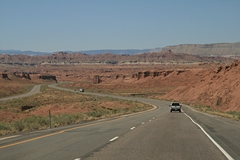
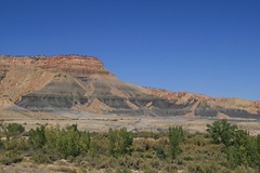
Dinosaur Tracks, San Rafael Swell, Crystal Geyser
Total miles:
304
Accommodation: Super
8, Green River
 We
drove north on Highway 191 and visited the Sauropod Track Site which
features original dinosaur tracks. At 9 a.m. we stopped at Subway in Green River
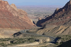
to get sandwiches for lunch, before we continued on the I-70 towards the San Rafael Swell
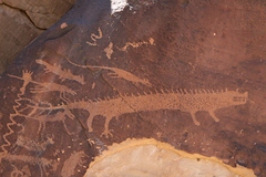
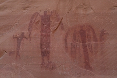
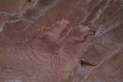
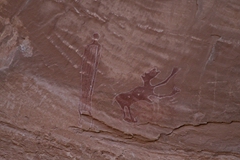
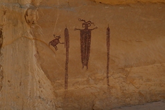
area. We visited Black Dragon Wash with Indian pictographs on the canyon
wall. Back on I-70 we stopped at the Spotted
Wolf and Black Dragon Canyon
viewpoints. At exit 131 we took the dirt road to Head of
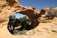
Sinbad, another beautiful pictograph panel. Dutchman Arch was close by.
Next was the Lone Warrior panel. Here we had our lunch. We
drove north on Highway 191 and visited the Sauropod Track Site which
features original dinosaur tracks. At 9 a.m. we stopped at Subway in Green River
to get sandwiches for lunch, before we continued on the I-70 towards the San Rafael Swell
area. We visited Black Dragon Wash with Indian pictographs on the canyon
wall. Back on I-70 we stopped at the Spotted
Wolf and Black Dragon Canyon
viewpoints. At exit 131 we took the dirt road to Head of
Sinbad, another beautiful pictograph panel. Dutchman Arch was close by.
Next was the Lone Warrior panel. Here we had our lunch.
Back on
I-70 came a few more viewpoints: Ghost Rock, Eagle
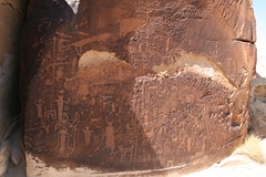
Canyon, Salt Wash. At exit 99 via Emery and Moore we drove to the Rochester
Rock Art Site, which shows Indian petroglyphs, not painted on but carved into the
stone.
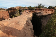
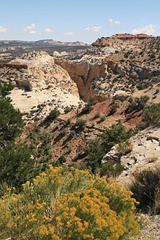
 At the end of another dirt road
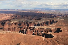
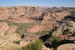
we reached Wedge Overlook with a great view of the canyon below. It was
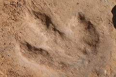
3:30 p.m. Along Buckhorn Wash Road we discovered a dinosaur
track (not
so easy to find) and we had a look at the Buckhorn Wash Pictograph
Panel before we
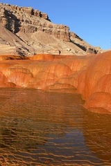
got back onto I-70 to Green River. Here we visited the Crystal Geyser
before checking into the Super 8 motel ($63 plus Tax
AAA rate). We had dinner at
the Tamarisk Family Restaurant. At the end of another dirt road
we reached Wedge Overlook with a great view of the canyon below. It was
3:30 p.m. Along Buckhorn Wash Road we discovered a dinosaur
track (not
so easy to find) and we had a look at the Buckhorn Wash Pictograph
Panel before we
got back onto I-70 to Green River. Here we visited the Crystal Geyser
before checking into the Super 8 motel ($63 plus Tax
AAA rate). We had dinner at
the Tamarisk Family Restaurant.
Here
are more details about the San Rafael Swell.
|
|
|
|